|
Raymond Battlefield Walking Trail Project
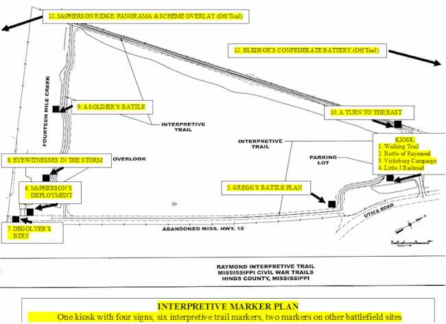
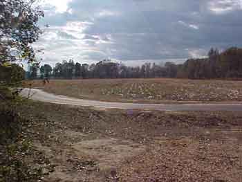
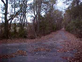
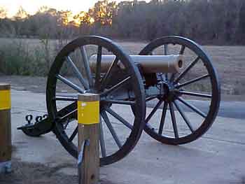
The first walking trail to be constructed on the Raymond battlefield—an asphalt ribbon that will encircle the 23.6 acre Friends of Raymond tract located at Fourteenmile Creek west of modern Highway 18—is now completed. Funding for the nearly $250,000 trail comes from an ISTEA (Intermodal Surface Transportation Equity Act) federal grant to the State of Mississippi. The one mile trail, with visitor parking lot, will serve as the lynchpin for battlefield visitation and interpretation. Upon completion of the trail, plans include battlefield interpretive signage and Civil War cannon.
The trail uses existing portions of old Highway 18, including the early 1900s concrete bridge over Fourteenmile Creek. Along the banks of this creek Colonel Hiram Granbury’s 7th Texas Infantry fought hand-to-hand with the Union foot soldiers and artillerymen of Major General John Logan’s division. Departing the old highway at the bridge, the trail parallels the historic and scenic sand-beached creek in a westward jaunt to the old bed of the Little J Railroad, constructed in the early 1870s to connect Jackson with Natchez. At the old railroad bed, the trail turns northeast and follows the old steam locomotive path towards Raymond. After approximately 1/3 mile, the path turns east across the cotton field to the new parking lot, situated on the northern edge of the Friends of Raymond property, and then runs east to the old Highway 18 bed. Once at the old highway, which is adjacent to the trail parking lot, the path follows the old concrete road south to the old Fourteenmile Creek bridge, completing the circle.
The trail will provide interpretation of late 19th Century railroad transportation as well as the predecessor of Highway 18—an early 19th Century dirt wagon road from Utica to Raymond. Of course, the May 12, 1863, Battle of Raymond will be interpreted. Friends of Raymond has been working for almost two years with MDAH, MDOT, and managers from PBS&J, and Neel-Schaffer, Inc. to ensure that this project meets the needs of the Friends membership and the local community. The project is an exciting one that promises bigger and better things for the Raymond battlefield by making it accessible to the public. It is the first major development of the battlefield property for historic tourism. Sixty-five acres have been acquired in three separate parcels, and now one of these parcels will soon be accessible and understandable: one parcel interpreted and two to go.
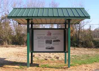
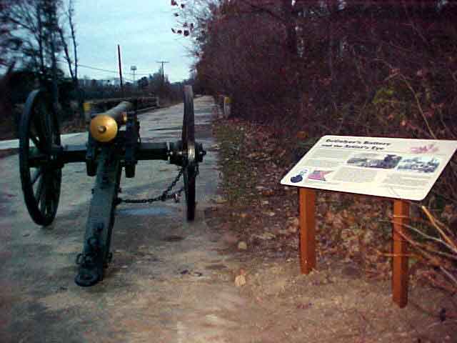
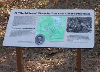
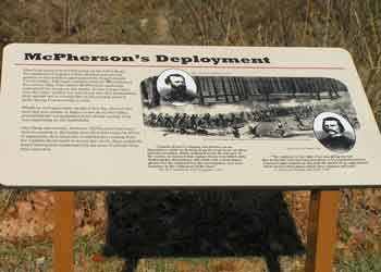
Ask the average tourist who has visited a battlefield—any battlefield—about interpretive signage. Without the signage a visitor is virtually lost as far as what happened, where it happened, and when. Until December 2006, this was the case in Raymond; that is, for 143 years there were no signs to designate and interpret the Civil War battle, with the exception of one state historic marker along HWY 18 at Fourteenmile Creek. Along that creek on a muggy day in May of 1863, almost 12,000 soldiers of General Ulysses S. Grant’s army ran headlong into 3,000 Confederates in a pivotal battle of the Vicksburg Campaign. However, the situation has taken a dramatic turn thanks to a Federal Highway Administration and Mississippi Department of Transportation TEA-21 grant.
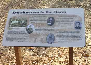
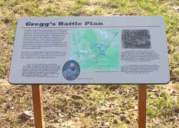
This project had long been on the drawing board, and with TEA-21 funding approval about a year ago, things began to move quickly. Jim Woodrick, then Civil War Sites Historian of the Mississippi Department of Archives and History, notified Friends of Raymond of the number of signs that could be financed. Project management was awarded to PBS&J, a planning, engineering, and construction management firm in Jackson. Soon, Cavett Taff of Pencil 2 Paper Exhibit Design of Jackson contacted and worked closely with Parker Hills, President of Friends of Raymond, for signage subject matter, research, and sign location. Finally the signage construction and installation was accomplished by Exhibits, Etc., of Scott, LA. Now the highly anticipated signs are finally in the ground, with six trailside signs and a four-sign kiosk at the ¾ mile Raymond Battlefield Interpretive Trail. The trail signs are complemented by two off-trail signs: one on McPherson Ridge on the west side of HWY 18 about ½ mile south of the walking trail, and one at the corner of Old Port Gibson Road and Port Gibson Street. The McPherson Ridge sign provides an interpretation of the panoramic view from that location, and the Old Port Gibson Road sign interprets the artillery action at that location. But the ¾ mile walking (now interpretive as well as walking) trail is where the signage “sings” as the tourist views a Vicksburg Campaign overview at the kiosk, and learns what to expect as the trail is experienced. Even the “Little J Railroad” which once connected Jackson to Natchez and ran through Raymond and the battlefield is discussed at the kiosk. As the scenic trail is traversed the visitor learns the Confederate and Union battle plans, the action at the actual points of combat, and the significant results of the Battle of Raymond. Eyewitness accounts grace the panels, and rare battlefield drawings by an on-the-scene reporter add meaning to the action. With the new cannon on the battlefield the overall experience can be much more than just a good walking exercise—it can add to the visitor’s appreciation of the history and heritage of Raymond, Mississippi. Visitors to the Raymond Interpretive Trail are welcome anytime during daylight hours, seven days a week, and admission is free. Friends of Raymond has printed a free color map to direct you to the battlefield and its associated signage. To pick up a copy in Raymond just ask at Merchants and Planters Bank, the Hinds County Courthouse, the Raymond Chamber of Commerce, or the Mayor’s Office.
Photographs courtesy of Parker Hills and Rebecca Blackwell Drake
| Home | About FOR | Pilgrimage | Reenactment | Book Store | Articles of Interest | Contact Us |
copyright © 2006 Friends of
Raymond |